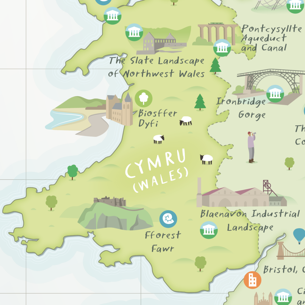
- New map launched that includes all 58 UK UNESCO sites for the first time
- Map illustration by artist Tom Woolley
- Visitors encouraged to discover new sites and destinations on their doorstep
Ignite your summer adventures and discover Fforest Fawr Geopark alongside 57 other unique UNESCO sites in the UK and crown dependencies thanks to a newly illustrated map, now available to download for free from the UK National Commission for UNESCO.
From expansive mountain ranges and stunning coastlines to vibrant cities and rural landscapes – the UK’s UNESCO sites are destinations of world-class natural and cultural heritage. For the first time a map, designed by the creative cartographer Tom Woolley, brings together all of the Biosphere Reserves, Creative Cities, Global Geoparks and World Heritage Sites across the British Isles that are waiting to be discovered.
Visitors to the sites are invited to immerse themselves in the spectacular vistas of the slate landscape of Northwest Wales or the Scottish Highlands. Dive into the literary heritage of Manchester or Edinburgh. Scale the mountains of the English Lake District or the peaks of Fforest Fawr. Uncover legends and folklore along the Giant’s Causeway or Stonehenge. Breathe in the sea air of Brighton and Lewes, North Devon or the English Riviera. Tackle the northernmost frontiers of the Roman empire by foot or by bike. Stroll around one of the great spa towns of Europe in Bath or a landed estate at Blenheim Palace. And dance the night away in an iconic concert hall in Belfast or at a festival under the stars at one of the world’s largest deep space observatories at Jodrell Bank.
The new map, released online this week, includes 29 World Heritage Sites, 13 Creative Cities, 9 Global Geoparks and 7 Biosphere Reserves that cover 13% of the UK’s landmass. Most of the sites are free to enter and conveniently accessible by public transport offering the public new experiences to discover UNESCO sites in the UK and mark this summer with a visit to one of the world’s most special places.
Over the forthcoming months Fforest Fawr Geopark will offer visitors the chance to enjoy walks in some of our most interesting landscapes. Watch out for our self-guided Geotrails.
James Bridge, Chief Executive and Secretary-General of the UK National Commission for UNESCO said: “This new UNESCO in the UK map will inspire people for places to visit. It shows at a glance the breadth of amazing natural, cultural and built heritage designated by UNESCO as internationally significant in the UK. This great map highlights places to explore, on your doorstep and further afield, both the famous and those to discover for the first time.”
First Minister of Wales, Mark Drakeford said: “I’m immensely proud that Wales is home to four UNESCO World Heritage Sites. This new map beautifully illustrates our world class destinations, and as we continue to protect these sites, their significance will be enjoyed by generations to come. Wales is an open and welcoming nation, one that invites the world to discover our natural wonders, culture and heritage which UNESCO sites have to offer.”
Alan Bowring, Geopark Officer for Bannau Brycheiniog National Park said “Bannau Brycheiniog National Park boasts both a Global Geopark and a World Heritage Site with both Fforest Fawr and Blaenavon Industrial Landscape featuring on the map. Visitors can follow the wealth of stories behind both of these landscapes; geological ones playing out in ‘deep time’ and human ones from the more recent past”
The map was produced by the UK National Commission for UNESCO as part of its Local to Global project, made possible with the GREAT Campaign and The National Lottery Heritage Fund, with thanks to National Lottery players. Local to Global aims to develop a resilient network for UNESCO Designated Sites in the UK.
The map can be downloaded from: https://unesco.org.uk/our-sites
ENDS